HIKE, BIKE, SKI or RIDE THE KVT (equestrian use designated between Westline & Mount Jewett, follow signs at KVT East & Tally Ho Trailheads to cross under US Route 219).
Index
Discover the Kinzua Valley Trail

Construction is now underway for the final section through the Allegheny national forest. this is east of tally ho to Guffey, utilizing the old Guffey road to the mj2kb trail that connects to the Kinzua bridge state park.

us route 219 to guffey equestrians
The Kinzua Valley Trail gently winds alongside the Kinzua Creek, following the path of the old “Valley Railroad” grade that cuts through one of the most magnificent valleys in the Pennsylvania Wilds region. The trail currently spans 16 miles in McKean County within the Allegheny National Forest. The trail is designated as non-motorized except for electric-powered wheelchairs (no golf carts or similar vehicles). Hiking, biking, jogging and cross-country skiing are all approved uses for the trail, and equestrian use is permitted between the Westline Trailhead and the Mount Jewett. (There is a hitching Rail at the Tally Ho Trailhead Parking area and a “Highline” at the Westline Trailhead/Parking area.) See the Horse Map HERE.
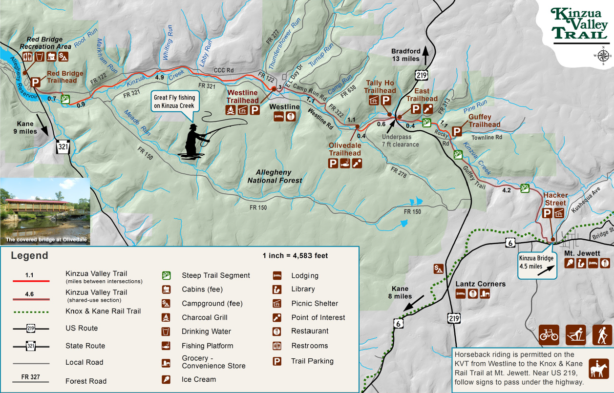
In the summer of 2016, the Kinzua Valley Trail was extended four miles from Markham Run to Red Bridge; then 2 miles from the Village of Westline to Olivedale. the KVTC received a grant on 2021 from DCNR and has developed additional trail from Westline, down Camp Run Road to the Kinzua Creek (this area known as “Olivedale”). Now that the bridge is in place across the Kinzua Creek, the trail continues to US RT 219 (Tally Ho). Work is nearing completion, blazing the trail 11 more miles to connect with the Knox & Kane Rail Trail which takes you to Mt Jewett & the Kinzua Bridge State Park.
Trailheads are currently located in the Village of Westline, near the intersection of Westline and Church roads; the Red Bridge Recreation Area (US Route 321); on U.S. Route 219 near its intersection with Westline Road (Tally Ho); and 2 more trailheads on the Kinzua Valley Trail East section. One trailhead is east of the U.S. Route 219 bridge, and the other one located at Guffey. Plans are in the works to improve the road from Guffey to Mt Jewett, connecting to the Knox & Kane Rail Trail at the Hacker Street Pavilion & Parking Lot. From Red Bridge to Kinzua Bridge State Park is 21 miles.
The trail is 8 feet wide of crushed limestone with a 2-foot berm on each side.
EAST MEETS WEST:
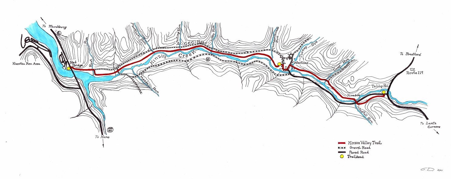
The final trail section from Tally Ho to Kinzua Bridge State Park is completed. the Kinzua Valley Trail has 16 miles of trail with a total of 5 trailheads and 6 bridges. It connects to the Knox & Kane Rail Trail in Mount Jewett at the Hacker Street Pavilion. See our new map:

Electric & Regular Bike Rentals Available
Call Alleghany Adventure Rentals at (814)598-6698 for more information

CLICK TO DOWNLOAD LARGER, PRINTABLE VERSION OF MAP